
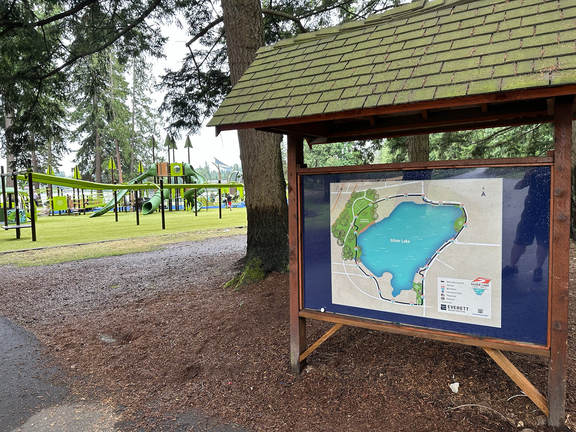
Silver Lake Loop Trail map designed for the City of Everett. Six versions of the map were produced for display at kiosks along the loop trail.
Roles: Graphic Design, Mapping
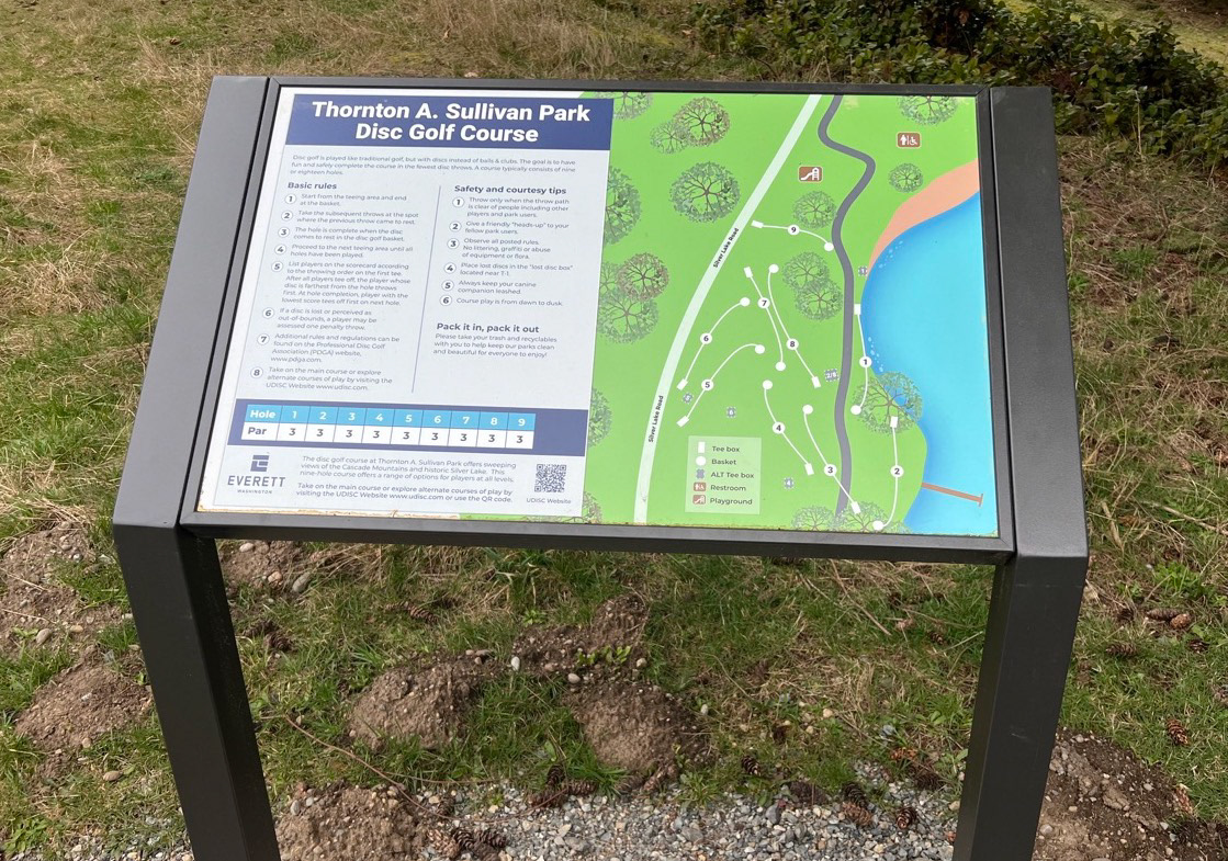
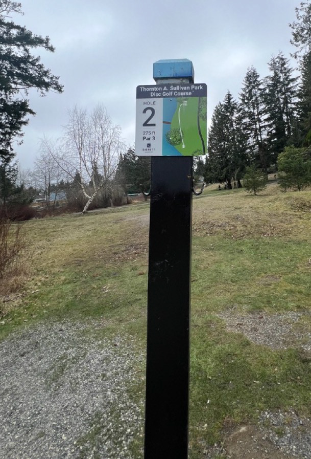
Thornton A. Sullivan Park disc golf course map and hole markers designed for the City of Everett.
Roles: Graphic Design, Mapping
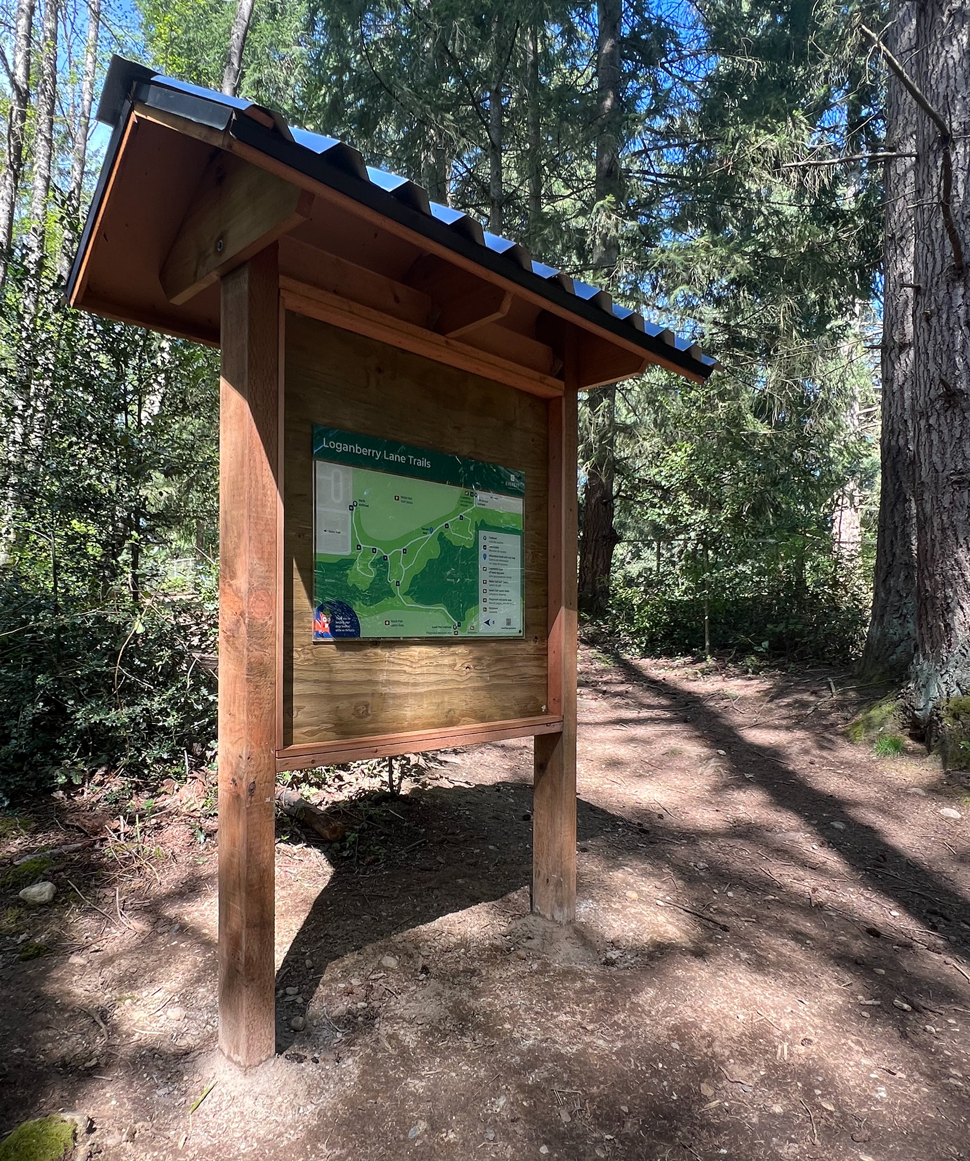
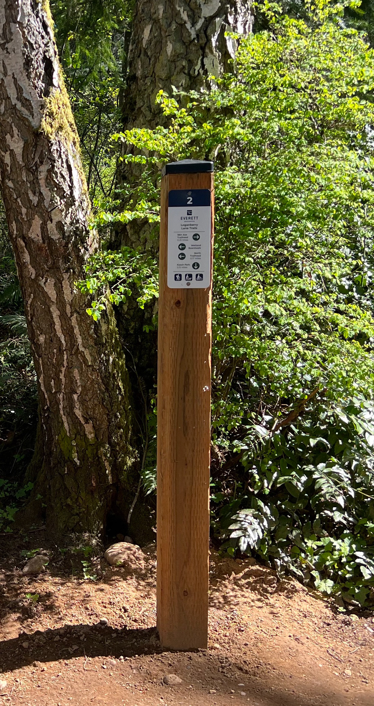
Trail map and wayfinding signage for Loganberry Lane Trails designed for the City of Everett.
Roles: Graphic Design, Mapping
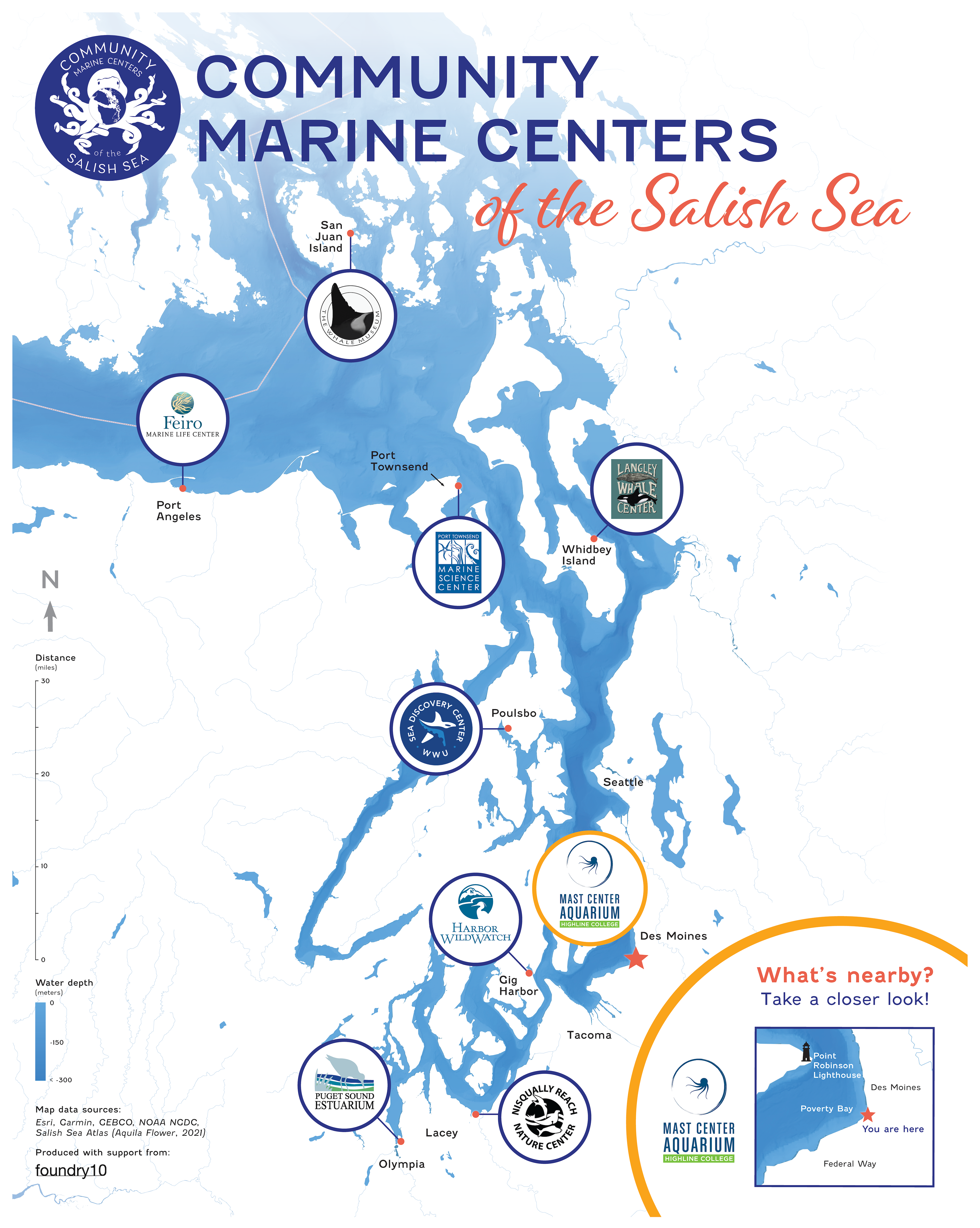
Map of Community Marine Centers of the Salish Sea designed for foundry10 in collaboration with MaST Center Aquarium. Nine map versions were produced for display at marine centers, each with a separate inset map specific to the surrounding area.
Roles: Graphic Design, Mapping
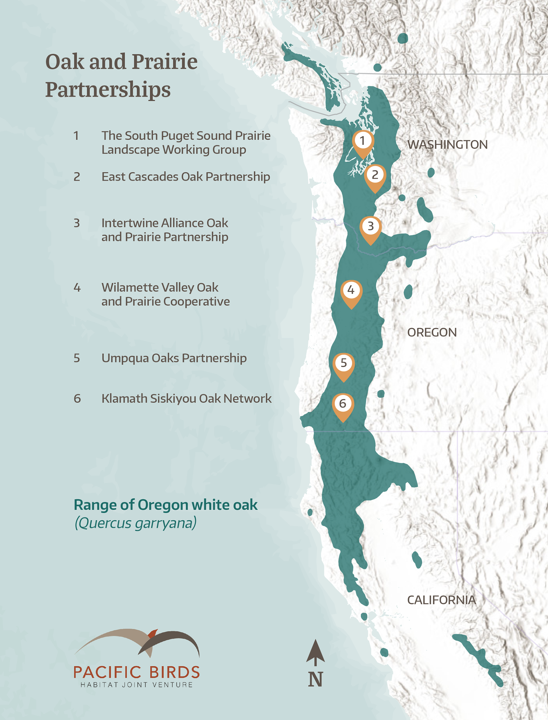
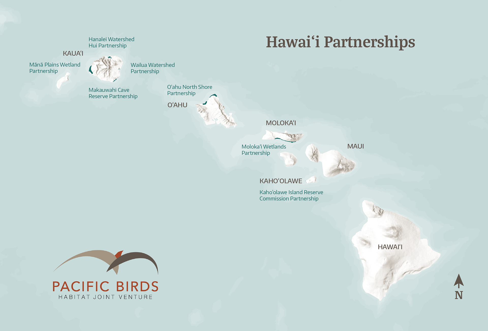
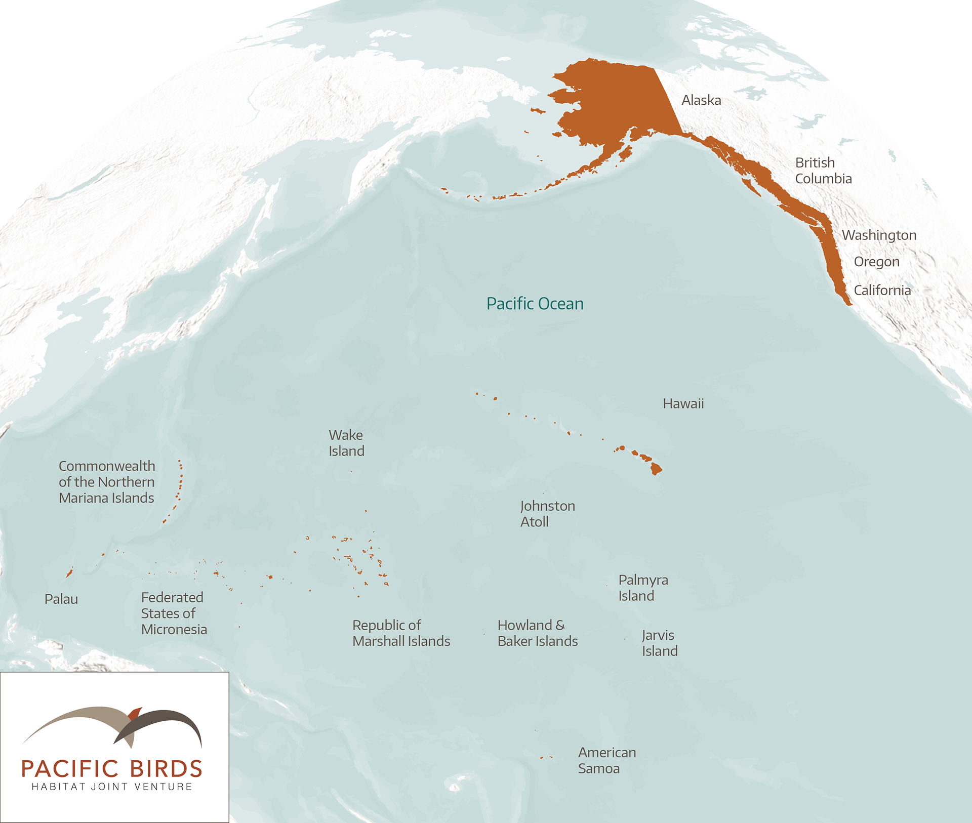
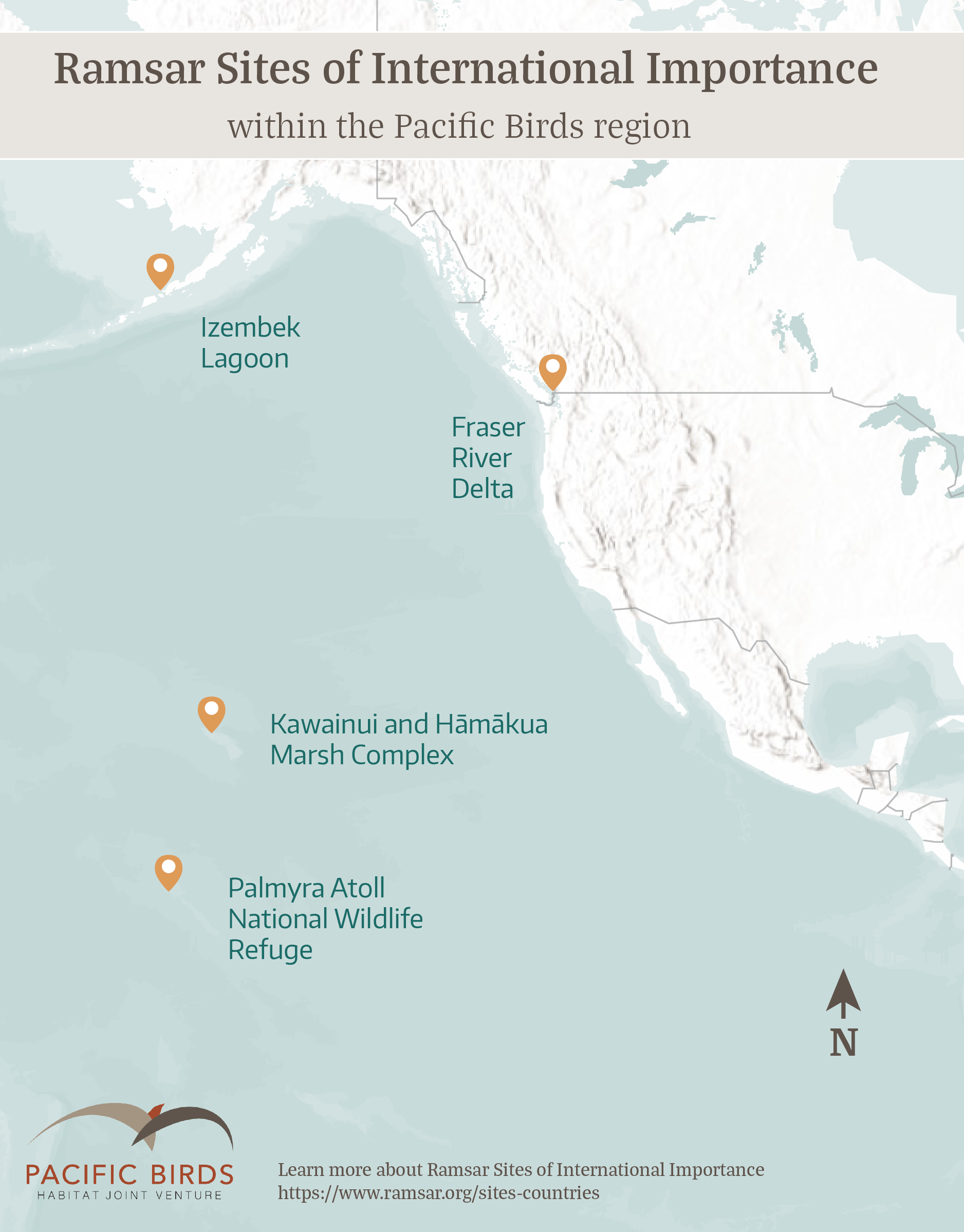
A collection of maps designed for Pacific Birds Habitat Joint Venture for use in digital materials.
Roles: Graphic Design, Mapping